Geographic Information System necessary for resource management and research—Prof. Okae-Anti
A Professor at the Soil Science Department of the University of Cape Coast, Prof. Daniel Okae -Anti has stressed the need to factor in issues relating to the environment in research and development work.
Advertisement
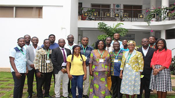
Prof. Okae-Anti, who was part of participants at a five-day training programme organised for Geographic Information System (GIS) and Remote Sensing professionals in resource research by the United Nations University (UNU) in Accra, said GIS is not reserved for science-based people and that it cuts across all fields.
“The interesting thing is that GIS is not reserved for science-based people, it cuts across all fields, making it a powerful tool to adopt for research work,” he said.
A press statement issued by United Nations University-Institute for Natural Resources in Africa (UNU-INRA) in Accra on Friday, October 19, 2018, said the training was aimed at equipping professionals with theoretical knowledge and hands-on skills in GIS and Remote Sensing to advance research and inform decision making in natural resources management and other relevant development-driven endeavours in Africa.
GIS is a computer-based tool for mapping and analysing feature events on earth as well as serving as a powerful tool for research and management.
It manages location-based information and provides tools for display and analysis of various statistics, including population characteristics, economic development opportunities, and vegetation types.
Similarly, it also helps in explaining events, predicting outcomes, and planning strategies.
Remote sensing, on the other hand, is a technique used to survey and collect data regarding an object or a phenomenon without any physical contact with the object or the phenomenon being observed.
The Director of UNU-INRA, Dr Fatima Denton, speaking at the closing session of the training said GIS is a key part of UNU-INRA’s work.
“We are looking at how we can better conserve, better harness Africa’s natural resources,” she noted, pointing out that “the detection aspect of remote sensing works like an alert system that allows us to have better preparedness against natural disasters.”
Dr Denton has, therefore, called on African governments to adopt and improve their use of GIS technology, and on organisations to be more open to
Participants at the training were taken through
UNU-INRA’s mandate is to contribute to the sustainable management of Africa’s natural resources through research, capacity development, policy advice and dissemination.
The UNU-INRA contributes to the sustainable development, management, and governance of Africa’s renewable and non-renewable natural resources.


