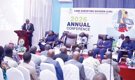
Land surveyors in the country have been urged to move beyond traditional measurement and mapping by adopting spatial intelligence capable of supporting national planning, development and informed decision-making.
They have also been encouraged to make effective use of technological advancements, together with stronger collaboration among built-environment professionals, for effective service delivery.
The Chief Executive Officer (CEO) of the Land Use and Spatial Planning Authority (LUSPA), Dr Kwadwo Yeboah, who made the call, also challenged survey professionals to break down silos and work more strategically to address the planning and physical development challenges confronting the country.
He was addressing the annual conference of the Land Surveying Division (LSD) of the Ghana Institution of Surveyors (GhIS) in Accra last Thursday.
The conference was held on the theme: “Advancing Land Surveying through Innovation, Collaboration and Stakeholder Engagement.”
Conference
The conference also received brief solidarity and goodwill messages from representatives of other divisions of GhIS and sister professional bodies, reinforcing the need for interdisciplinary collaboration, professional unity and stronger partnerships in responding to Ghana’s built-environment and development challenges.
The conference included technical sessions and paper presentations, giving participants opportunities to explore emerging technologies, professional practice and new approaches to geospatial development.
It also featured the Annual General Meeting (AGM) of the Land Surveying Division, where members will deliberate on key professional and institutional matters, with discussions and decisions expected to help shape the future direction of the profession.
The discussions centred on a changing professional landscape in which the surveyor is expected not only to determine where things are but also to interpret spatial information and help decision-makers understand what it means for development.
Surveyors’ relevance
The President of GhIS, Emmanuel Kofi Cobbold, said land surveying remained fundamental to effective land administration, construction, spatial planning, environmental management and the protection of property rights.
He stressed the need for surveyors and surveying firms to continuously build their capacity to respond to changing technological and societal demands.
Also addressing the conference, the Chairperson of the Land Surveying Division, Dr Tina Dzigbordi Wemegah, said the modern surveyor must operate at the intersection of technology, governance and community engagement.
added that surveyors needed to move beyond boundary definition to become key contributors to spatial intelligence and national development.
Dr Wemegah urged surveyors to harness technologies such as Artificial Intelligence, Global Navigation Satellite System (GNSS), Unmanned Aerial Vehicles (UAVs), Light Detection and Ranging (LiDAR), Geographic Information System (GIS), and remote sensing to augment their practices rather than replace professional judgement.
Nexus
The Chairman of the Conference Planning Committee, Surv. Prof. Prosper B. Laari, linked the technological discussion to Ghana’s recurring floods, illegal mining, unplanned settlements, indiscriminate land sales, land disputes and growing pressure on urban infrastructure.
He said many of those challenges had strong spatial dimensions and required reliable spatial information, coordinated planning and responsible land governance, with surveyors becoming more visible in finding solutions.
The acting Director of the Survey and Mapping Division (SMD) of the Lands Commission, Naa Abu Seidu Zakariah, said efforts were underway to modernise the country’s geospatial infrastructure by expanding the Continuously Operating Reference Station (CORS) network.
He added that efforts were also being made to strengthen the national geodetic reference framework to support accurate and reliable surveying and mapping.